Rotation of Boundaries


Hello everyone,
I was wondering to know if there is a possibility of rotating the boundaries of a geological or numerical model?
The boundaries are currently defined by E-W and N-S axes, but the terrain or our area of interest is neither square nor rectangular and almost never follows N-S or E-W axes. Indeed, the orientation of our data may not correspond to a NSEW square or a rectangle, which makes it impossible to obtain an accurate model. We must therefore either reduce the size of the model or extrapolate beyond our data.
Here’s a little drawing that’s worth a thousand words.
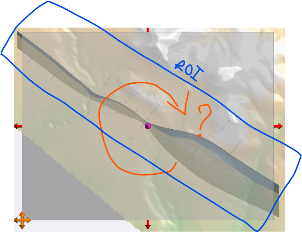
So, is there a way to rotate the boundaries so that they fit the size and orientation of our workspace better?
Regards,
François
Best Answer
-
Hello François,
You could use the lateral extent option by rigth click on your model boundary.
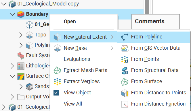
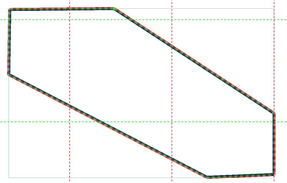
Before using that option, define the desire boundary of your GM with a polyline like this :
Following the boundary lateral extent option, you will be ask to chose you polyline.
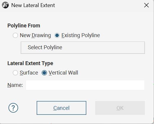
Click on Select Polyline and choose the polyline you've drawn previously (Mine is called Polyline 2) and click on OK. Leave Lateral Extent Type as it is on Vertical Wall.
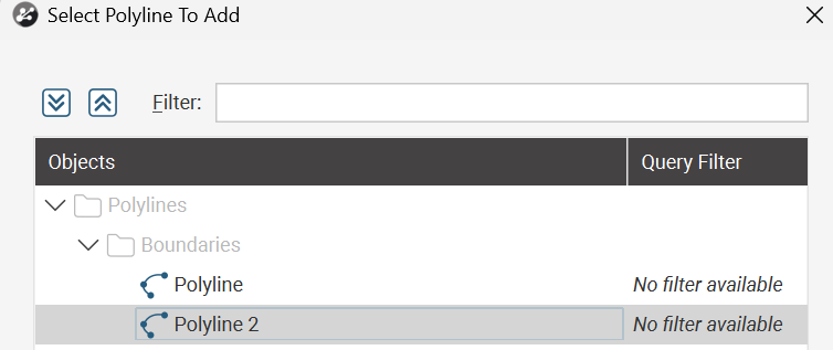
Let Leapfrog process your action and here you go.
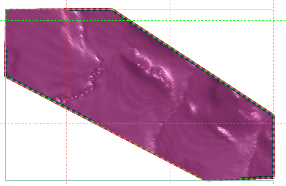
I hope that if this helps you. Let me know if it works.
Warm regards.
Bélarsi O.
1


Answers
-
Oh Yes! I have forgotten that way, thanks Belarsi.
But, why an option (very useful, all things considered) instead of a direct function with an icon?…0
Categories
- All Categories
- 303 Community
- 3 Get Started
- 17 Latest Releases
- 17 Member Spotlight
- 42 Learning
- 1.1K Products
- 567 Geology
- 540 Leapfrog
- 1 Volsung
- 26 Visible Geology
- 36 Data Management & Collaboration
- 14 MX Deposit
- 13 Central
- 9 Imago
- 137 Geotechnical
- 137 GeoStudio
- 332 Geophysics
- 321 Oasis montaj
- 1 Workbench
- SPIA
- 10 Res2DInv & Res3DInv
- 3 Evo
- 27 GX Developer