Tilt Derivative giving an error

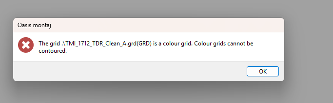
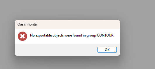
Hello! I'm a new user to Oasis. I have a TMI TIFF (I don't have raw data, but TIFF, TFW and ISI Common Export in a folder) that I imported into oasis. I managed to apply the correct coordinate and area (size), the went on to do 1DV, then smoothed the 1DV using the 3X3 Symmetric Convolution. It all worked until this point. After this I then went ahead to do a Tilt Derivative, as I would like to get my structural readings at depth and export them for Leapfrog 3D modeling. Is there anything I am doing wrong? Your assistance is highly appreciated.
Comments
-
Hi @NelaoNaimbale ,
Thank you for your interest and reaching out. It seems the grid you are working with is a colour grid. Can you please try using the Grid and Image > Utilities > Copy/Convert Grid(s) menu option and convert your grid to a Geosoft Grid? This should solve the issue.
Regards,
Farzaneh Farahani
Technical Solutions Specialist, Geophysicist1 -
@Farzaneh Farahani, converting the tiff to a geosoft grid is the first thing I did. Then I went past 1DV without a problem. Its the Tilt Derivative that kept giving that error. I even tried using the colour tool to generate a new map, using the histogram equalization and it still did not work. I ended up using 2D filtering, then butterworth filter; that way it ended up generating the Tilt derivative grid and then map. Then I extracted the structures as csv for leapfrog use. Would that be a workable choice for realiable results?
Thank you again
0 -
how did you convert a tiff to a geosoft grid?
0 -
I imported it via
(1) Grid and Image > Display on Map > Image (bmp, tiff etc)
(2) Then went back to Grid and Image > Utilities > Copy/Convert Grids (Input: TMI Tiff, output: TMI.grd, output format: Geosoft float (*.grd)
I don't have raw data, hence, I went that route. The tiff is provided together with a TFW, which I guess make the tiff compatible for upload into Oasis.
Happy to hear any suggestion or better way to work around images.
0

Categories
- All Categories
- 9 Community
- 3 Get Started
- 16 Latest Releases
- 15 Member Spotlight
- 42 Learning
- 7 Products
- 2 Geology
- 536 Leapfrog
- 1 Volsung
- 26 Visible Geology
- Data Management & Collaboration
- 14 MX Deposit
- 13 Central
- 9 Imago
- Geotechnical
- 136 GeoStudio
- 3 Geophysics
- 321 Oasis montaj
- 1 Workbench
- SPIA
- 10 Res2DInv & Res3DInv
- 3 Evo
- 27 GX Developer