How can I find what information is a model/block using to define its surfaces/volumes?


Hello,
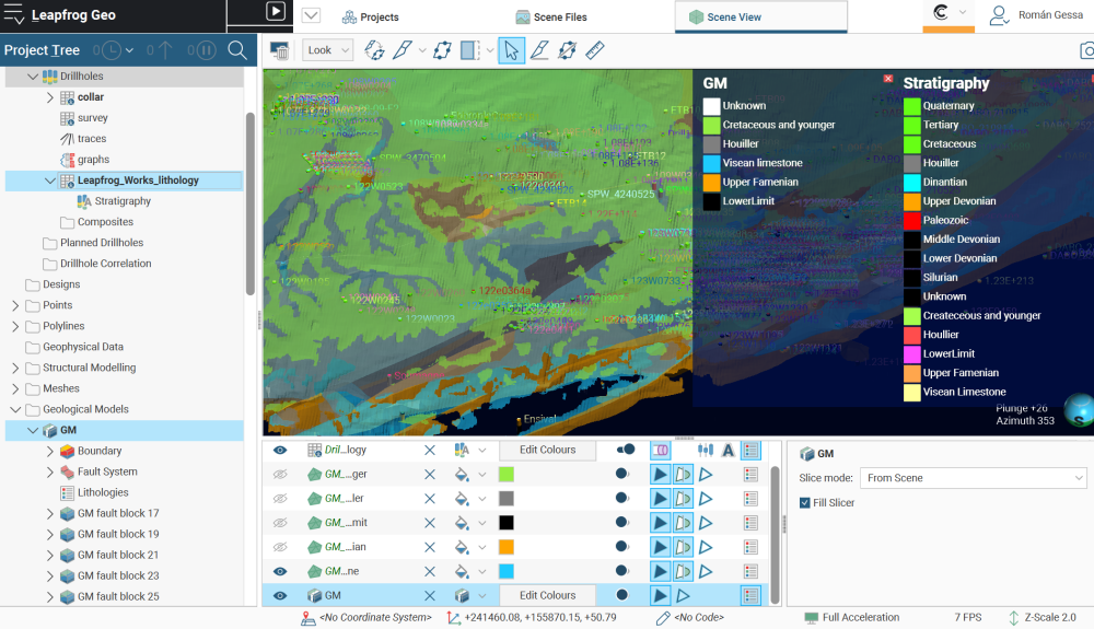
I have been given a large scale geological model in Leapfrog that I have to reinterpret/modify. This model has been built with loads of data (>1000 BHs, cross sections, maps) and blocks separated by faults. To modify the model I need to know first what information the model and the blocks are using. How can I find that?
Also, I wondered how the model only have 5 units meanwhile the drillhole stratigraphy (intervals) table have more than 10 lithologies defined?
Thank you in advance for any help, it is highly appreciated. And apologies if the question is generic of simple, although I about to finish Leapfrog Fundamentals 1 to 6 trainings, I am a recent user of Leapfrog.
Best wishes,
RG
Comments
-
Hi Roman!
Great, I'll answer your questions in order.
1. “To modify the model I need to know first what information the model and the blocks are using. How can I find that?”
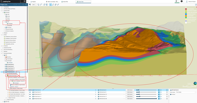
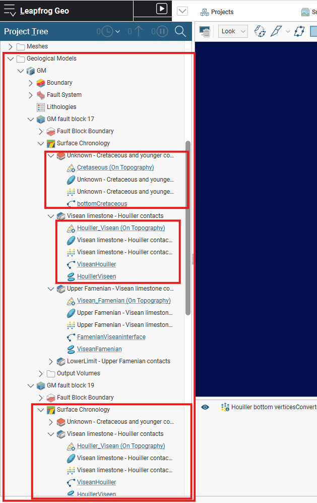
Answer: To find out what information is being used in the geological model, you need to review each of the “folders” in your model, starting with “Geological Models,” which in this case would be Fault System. When you open the folder, you will see the content used for modeling, as in the following example:
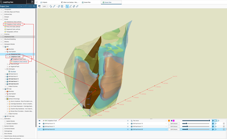
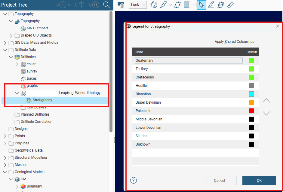
To find out which lithologies you are using and from which boreholes, you can check as follows:
2. “Also, I wondered how the model only have 5 units meanwhile the drillhole stratigraphy (intervals) table have more than 10 lithologies defined?”.
Answer: There are two possible answers to this question:
1) Regarding the units, they are usually grouped together to make the geological model more readable and interpretable, depending on the modeling team's objective. This can be done using the “New Column” -> “Group Lithologies” tool. In “Base Column,” select your boreholes and assign them a name.
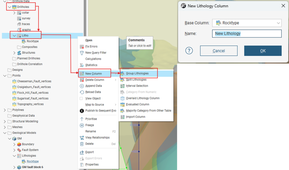
Next, select one of the lithologies from your surveys and click on “New Group” to create the new lithological group, then repeat with the lithologies you want to combine.
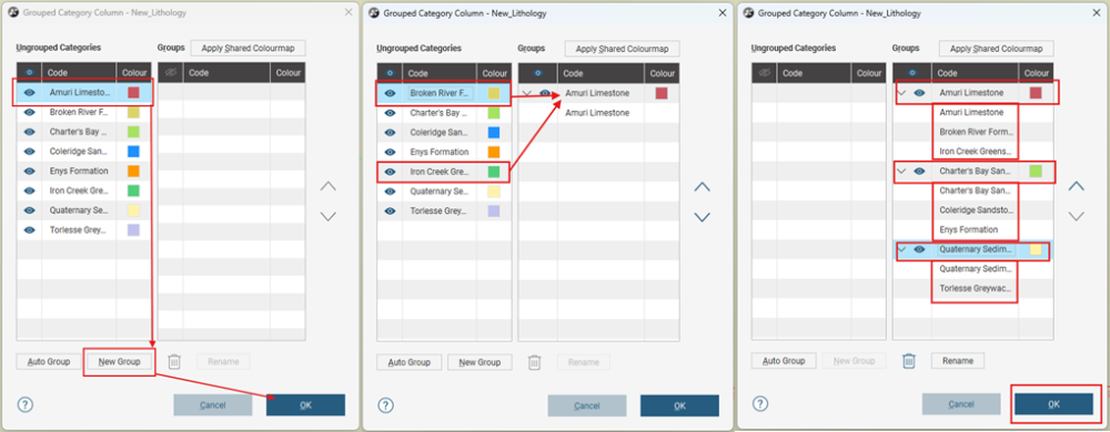
Generating a new column of grouped units:
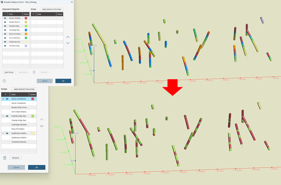
From the new lithological group, geological modeling can be started from “Geological Models.”
2) The second reason why there are fewer lithologies in the model than in the survey data is that they were simply not considered in the modeling.
Manuel Hinojosa
Geology Intern.
2 -
Hello Manuel,
Thank you very much for your help! It is very appreciated. With that I think that I have a better idea of the workflow in Leapfrog, some answers and new questions. If you, or anyone else, are interested, my new questions are these:
- Regarding the information use to build the model, I attached an screenshot. Is it possible that they didn't use drillhole information to build the model/blocks? Did they only use topography surface, polylines, structural data and points?
2. Regarding the units, and related to the information attached above, I think that they didn't group lithologies as I don't see that when I check the Lithologies withing the geological model or in the drillhole data table.
If I am right in these two case, how is the best way to modify/reinterpret this model? Would it be better an approach based on advance surface editing options like changing Surface Generation to Boundary filter by Only Drilling, or Snap to Data by Only Drilling (as my target is the information obtained from new drilled boreholes, or it will be better to use polylines?
Thank you for you help.
Best regards,
RG
0